
Meet The Missile Defense Agency’s Newest Radar: LRDR
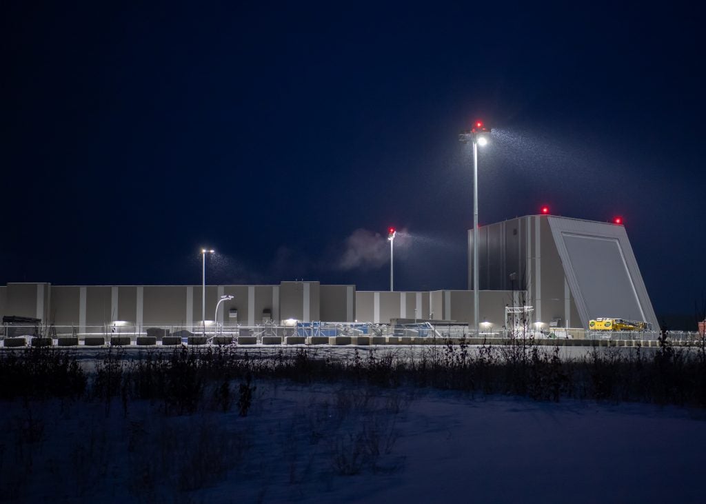
On December 6, the Missile Defense Agency held the fielding ceremony for the Long Range Discrimination Radar, marking a major milestone for the completion of military construction of the system ahead of its handover from the MDA to the Space Force sometime in coming years.
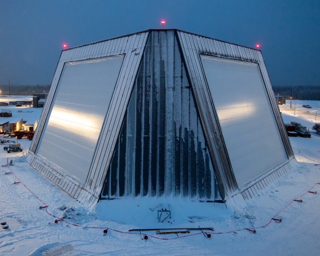
The LRDR is the latest generation of US Early Warning radars, the radar is located at Clear Space Force Station in Alaska right next to the older but now upgraded PAVE PAWS radar. The new radar uses Active Electronically Scanned Arrays, with each of the arrays measuring 60 feet (18 meters) high by 60 feet (18 meters) wide and operating in an S-band frequency.
The contract for the building, development, and installation of the LRDR was awarded to defense giant Lockheed Martin in October of 2015. The radar breezed through its Preliminary, Critical, and Final design reviews in 2017. Work on the radar site progressed smoothly over the years but came to an abrupt halt last year due to the global pandemic. Last June, MDA director, Vice Admiral Jon Hill told Senate Committee on Armed Services:
“We did have some pandemic delays. The Clear Air Force Base closed. We had radar equipment shipping there. We had to stop it and hold it up. But the team stayed on path, building that radar, and we have both panels completed this year. We are now doing radiation, which means the radar is up and running, doing low-power calibration, and we are going to learn a lot. It started as a very small-scale radar out in Morristown, New Jersey. It is now at its full array size, and we expect to have government acceptance by the end of this year.”
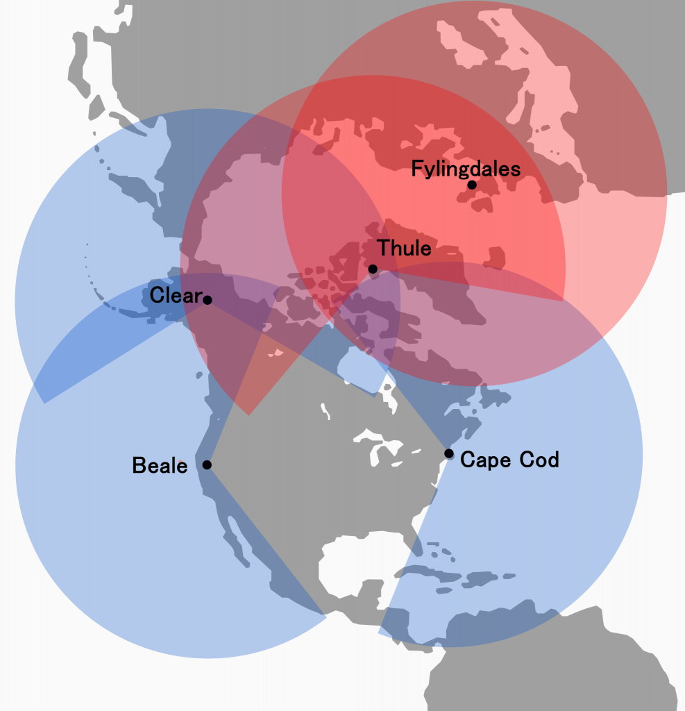
The LRDR will be part of the US’ Early Warning System which is made up of three Upgraded Early Warning Radars (UEWR) in the continental United States and two BMEWS sites in Greenland and the United Kingdom. The radar will be integrated with the Upgraded Early Warning Radars (UEWR) through the Ballistic Missile Command/Control Center (BMC3) network. Allowing the Ground Midcourse Defense system’s interceptor to leverage more accurate target information provided by the new radar as compared to the UEWRs.
Early Warning System which is made up of three Upgraded Early Warning Radars (UEWR) in the continental United States and two BMEWS sites in Greenland and the United Kingdom. The radar will be integrated with the Upgraded Early Warning Radars (UEWR) through the Ballistic Missile Command/Control Center (BMC3) network. Allowing the Ground Midcourse Defense system’s interceptor to leverage more accurate target information provided by the new radar as compared to the UEWRs.
A Brief History of the US Early Warning Systems
In the late 50s planners in the US began worrying about the predicted progress of the Ballistic Missile Threat to the Continental US, at the time the focus of the early warning systems in place was against Soviet bombers, through systems such as the SAGE and Distant Early Warning (DEW) system. The new ICBM threat required a system with not only more range but a wider view to give the US enough warning time against ICBM attacks.
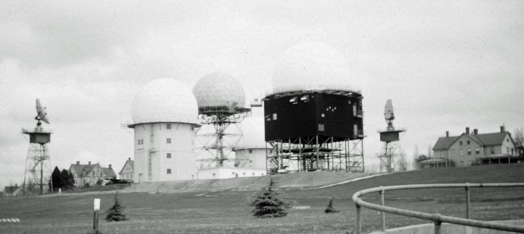
The system capable of meeting these tasks at the time would be the Air Force’s Ballistic Missile Early Warning System (BMEWS), it was made by the Radio Corporation of America and began early prototype testing in 1958 at Trinidad, British West Indies. The Air Force planned to deploy three operational sites which would provide cover against ICBMs in the entire Northern Hemisphere. The first site, Site I, was declared operational in October 1960 at Thule in Greenland, Site II in Clear, Alaska was declared operational in late 1961, and the last site, Site III in Fylingdale Moor, Yorkshire, England, was operational in September 1963.
Due to the ever-increasing threat from Soviet SLBM developments, a new system was needed to have early warning coverage against SLBM attacks in the Atlantic and Pacific. The positions of the BMEWS systems, which all faced North, meant that these systems would not be useful in the event of an SLBM attack. Following an exhaustive search for a system that was capable of meeting the requirements amid fiscal constraints, the Air Force fielded a limited capability for SLBM launch detection in the form of a modified AN/FPS-26 height finder radar. Six sites were selected for the deployment of the FPS-26 now redesignated FSS-7, the sites were at Point Arena, California; Mount Laguna, California; Mount Hebo, Oregon; Charleston, Maine; Fort Fisher, North Carolina; MacDill AFB, Florida; and Laredo, Texas.
Continued improvements of Soviet SLBM exceeded the detection ranges of the FSS-7 system and the Air Force was forced to look for a new system again. This time taking advantage of the advances in radar technology offered by phased-arrays, the Air Force would field the Perimeter Acquisition Vehicle Entry Phased-Array Warning System (PAVE PAWS). There were four planned operational sites in the United States located at Cape Cod Air Station, Massachusetts; Beale Air Force Base, California; Eldorado Air Force Station, Texas; and Robins Air Force Base, Georgia. The PAVE PAWS system had more coverage than the BMEWS radars (240° vs 120°) and more range than the FSS-7 system, thus giving the Air Force more warning time than all previous systems. Together, they would provide early warning coverage against Intercontinental Ballistic Missile (ICBM) and Submarine Launched Ballistic Missile (SLBM) attacks, in the event of an attack, the system would detect, track and predict impact points for Ballistic Missiles, this information would be fed back to NORAD headquarters in Colorado Springs.
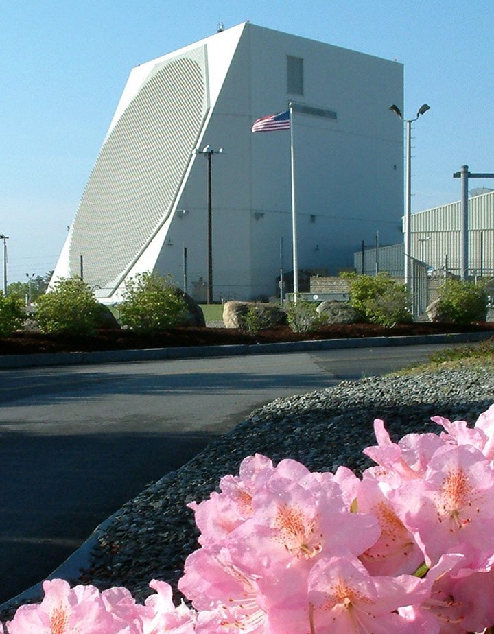
During the late 70s and early 80s, around the same time PAVE PAWS system began fielding, the Air Force looked at possible upgrades of the original BMEWS sites in Thule and Flyingdales using the same phased-array technology used in the PAVE PAWS. Following several cost-benefit studies, Congress approved the plans to upgrade both sites in 1979. After the end of the Cold War, the PAVE PAWS system in Georgia was decommissioned as a cost-saving measure, while the site in Texas was dismantled and shipped to Clear AFS, Alaska to replace the original BMEWS radars located there by early 2001.
In the Clinton era, modernization plans for the existing PAVE PAWS and BMEWS sites were announced. This would be known as the Upgraded Early Warning Radar program which would enable the integration of these radars into the National Missile Defense architecture at the time. Originally the radars were operated by the Air Force for warning against an attack as a part of the Integrated Tactical Warning/Attack Assessment (ITW/AA) system, as such they were not tasked with passing information to interceptors. The radars had to undergo these new upgrades to better discriminate between various sections of an ICBM or an SLBM by classifying what each radar observes into a “threatening” or “non-threatening” basket. The UEWR program would allow the radars to have improved signal processing and various other changes which would enable finer range resolution required for tracking and classifying smaller objects. This would allow them to pass on their track information to the Ground Midcourse Defense (GMD) system, to be used by the Ground-Based Interceptor (GBI).
Although the UEWR significantly improved the tracking and classification capabilities of the early warning radars, their discrimination capabilities were still limited. The upgrade gave the radars a range resolution of 5m², this means anything smaller than this such as re-entry vehicles that might be sized of 2m² or smaller would be beyond the discrimination capabilities of rhe radars. For years this has determined the launch “doctrine” of the GBI missile, due to the limited discrimination capabilities of radars, a “salvo” of missiles had to be launched at what the radars classify as a threat to ensure high certainty of a kill. Often these things might not be the main target but rather decoys or else just smaller debris rhe radar can’t fully categorize, this meant the entire inventory of 66 GBI missiles could be depleted by 16 ICBMs carrying simple decoys.
The LRDR is capable of detecting and discriminating against targets that the UEWRs would not be capable of even detecting. This is in part due to radar having a higher frequency and being built on an AESA architecture, allowing it to be more sensitive than the PESA architecture of the UEWRs. LRDR will be followed by the Homeland Defense Radar – Hawaii (HDR-H) which has been getting broad support from Congress, the radar will have a single face instead of the dual-faced setup of the LRDR. HDR-H is still in its early phase with MDA scouting for possible locations. Upon reaching operational fielding in the future, HDR-H and LRDR will bring the United States’ early warning network into the modern era.